Ngorongoro Conservation AreaThe Ngorongoro Conservation Area is a UNESCO world heritage site, located just 180Kms west of Arusha. The conservation area is administered by the Ngorongoro Conservation Area authority, a wing of ....
|
Details
The Ngorongoro Conservation Area is a UNESCO world heritage site, located just 180Kms west of Arusha. The conservation area is administered by the Ngorongoro Conservation Area authority, a wing of the Tanzanian government. The reason for this piece of paradise being called a conservation area is its multiple land use plans where people, in this case the indigenous Maasai and their cattle, are allowed to live alongside the wild animals in harmony, the first example of its kind in the world! The conservation area, covering an area of 8292 sq. Kms was made a man and biosphere reserve in 1971 and a world heritage site by 1979.
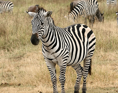
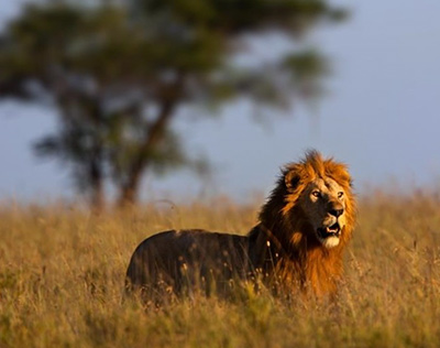
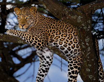
The jewel of the NCA however is the legendary Ngorongoro crater. Formed some 2.5 million years ago from an enormous explosion of magma that caused the once enormous volcano on the western flank of the rift valley to implode under its own weight, the Ngorongoro crater (caldera), at 600 meters deep, 20 kilometers wide and covering an area of 264 sq. kilometers is the largest unbroken, unflooded caldera in the world. With an abundant wildlife population of up to 25,000 to 30,000 large mammals including the rare Black rhinos, huge prides of lions, the elusive leopard and gigantic tuskers, the crater is one of the few places in the country where the big five can all be easily viewed in a day.
Covering only 3% of the entire conservation area, the crater is usually what most visitors get to see of the NCA though there is much more besides. In the west lie the extensive Salei plains, part of the stomping and calving grounds for the annual wildebeest migration. At the end of the plains lies the Olduvai Gorge, “the cradle of mankind”, where the legendary 2 million year old Homo habilis was unearthed.
To the northeast are two small craters, the Olmoti and Empakaai which together form the crater highlands. Both are very rich in wildlife yet both see a very limited number of visitors each year. There are the shifting sands, elegant black sand dunes some 15 kilometers northwest of Olduvai gorge, that move a little each year in the same direction (roughly 15m in an eastward direction), leaving one wondering at the marvels of nature. All this makes Ngorongoro Tanzania’s most visited wildlife area, a place that enchants, and few leave the place disappointed.
Climate:
Like the Serengeti, the Ngorongoro Conservation Area experiences two main seasons. The dry season is June – October. The short rainy season is from November – Mid December, and the long rains from March – May. Even during the wet season it seldom rains throughout the day.
Due to the variation in altitude temperatures in the Ngorongoro vary from 3C – 35C. It gets very cold during nights therefore be well prepared. The coldest months are June – August.
The dry season has the added advantage of animals congregating along permanent water sources making them easy to spot whilst the wet season has superb scenery and animals congregate on the short grass plains.
Best time to visit:
Accessible throughout the year. April and May are the most wet months however it seldom rains throughout the day.
For those interested to visit the parks when they are less crowded, the wet season offers the best scenery with just a handful of tourists. Mega Adventures offers best priced packages for this time of travel. Although it may rain, it will rarely rain for more than a couple of hours during the day. March and Early April can be ideal, sometimes with the rains coming in late it’s a bingo to travel at this time.
November and early December is also ideal if you don’t mind having some showers during the day.
Accessibility:
Ngorongoro Conservation Area is accessible from Arusha town by road which is 180kms.
Accommodation:
There are several accommodation options, from Camping on the crater rim, Tented Camps and Luxury lodges of different budget levels. All inside the park boundary.
Activities:
- Game drives
- Balloon Safaris
- Walking Safaris
- Hiking
- Maasai Cultural Interaction
- Camping
- Archaeological tour
|
|
Serengeti National ParkTanzania’s oldest national park is also one of the world’s best known wildlife sanctuaries. At 14,763 sq. Kms, Serengeti was second in size only to Ruaha National Park, now third in siz....
|
Details
Tanzania’s oldest national park is also one of the world’s best known wildlife sanctuaries. At 14,763 sq. Kms, Serengeti was second in size only to Ruaha National Park, now third in size after the newly annouced Nyerere National Park of the Selous Game Reserve. Serengeti National Park is certainly one of Tanzania’s most precious jewels. Protected for almost a century now, the sanctuary was declared a national park in 1959 and is also a world heritage site and an international biosphere reserve, alongside Ngorongoro.
The Serengeti is home to the world’s largest and most spectacular wildlife migration, at the peak of which it contains the largest concentration of mammals on earth. Bordering Ngorongoro to the south and south east, Kenya’s Maasai Mara to the North, Maswa Game Reserve to the west and south west, Loliondo Game Reserve to the east and reaching within 8km of Lake Victoria to the North West, any safari here promises wildlife galore, especially when the annual migration of plains game and their attending predators is in residence.
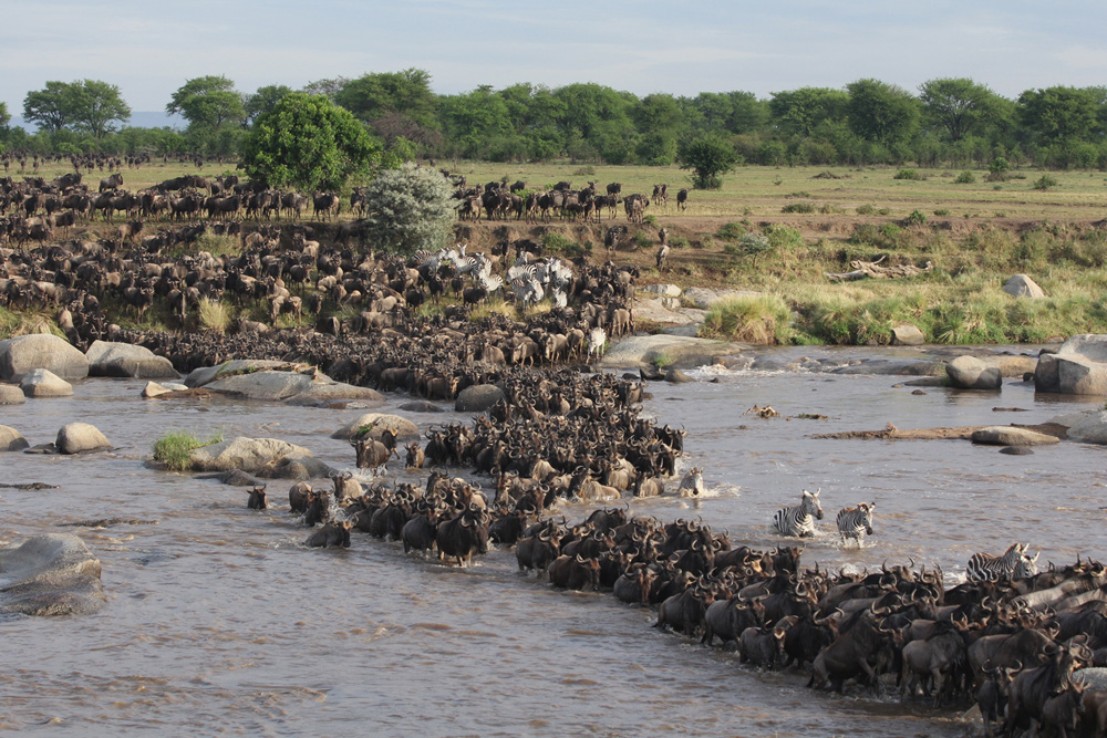
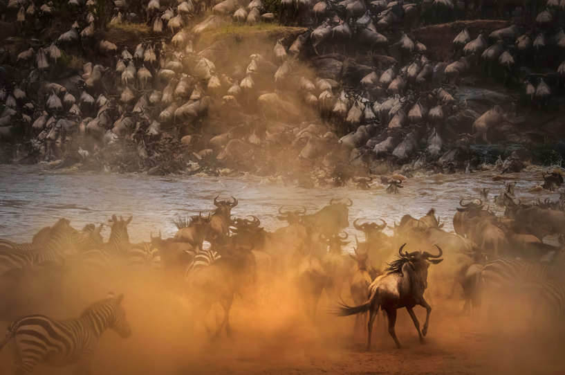
Serengeti is derived from the Maasai word “Siringet” meaning the endless plains. Recently claimed the 7th world wide wonder, Serengeti owes its legendary fame to the annual 800km migration of over 2.5 million animals, forming columns of animals up to 40kms long! The migration offers visitors with one of nature’s most staggering displays, one in which the ever watchful predators play vital part. In this epic journey, the migration has to cross their biggest obstacles, the river crossings, to get to the green pastures on the other side. These rivers, the Grumeti in Serengeti and the Mara along the border with Kenya to the North, can both be the scenes of true carnage, as weak, panicked and old animals fail to cross the raging tides ending up in the jaws of crocs or get piled in a writhing mass of bodies where they are left at the mercy of the vultures and other scavengers. The migration’s never ending cycle is fueled by a seasonal search for green, fresh pastures and water dictated by the rains.
The endless sun burnt savannah that turns into a shimmering golden horizon during the dry season and covers only a third of the park isn’t the only thing that the Serengeti has on offer. Seronera, with its wooded hills, lightly wooded valleys, rivers lined with fig trees and acacia woodland stained orange by dust offers some excellent year round game viewing even when the migration isn’t in residence. To the north along the border with Kenya, the country is dominated by thorny acacia woodlands. To west, the corridor that runs along the Grumeti River reaches very close to Lake Victoria, and the evergreen forests flanking the river provide a home to a variety of primates and leopards whilst the river itself is excellent habitat for water birds and crocodiles which in turn prey on the thirsty animals that come down to drink during the dry season.
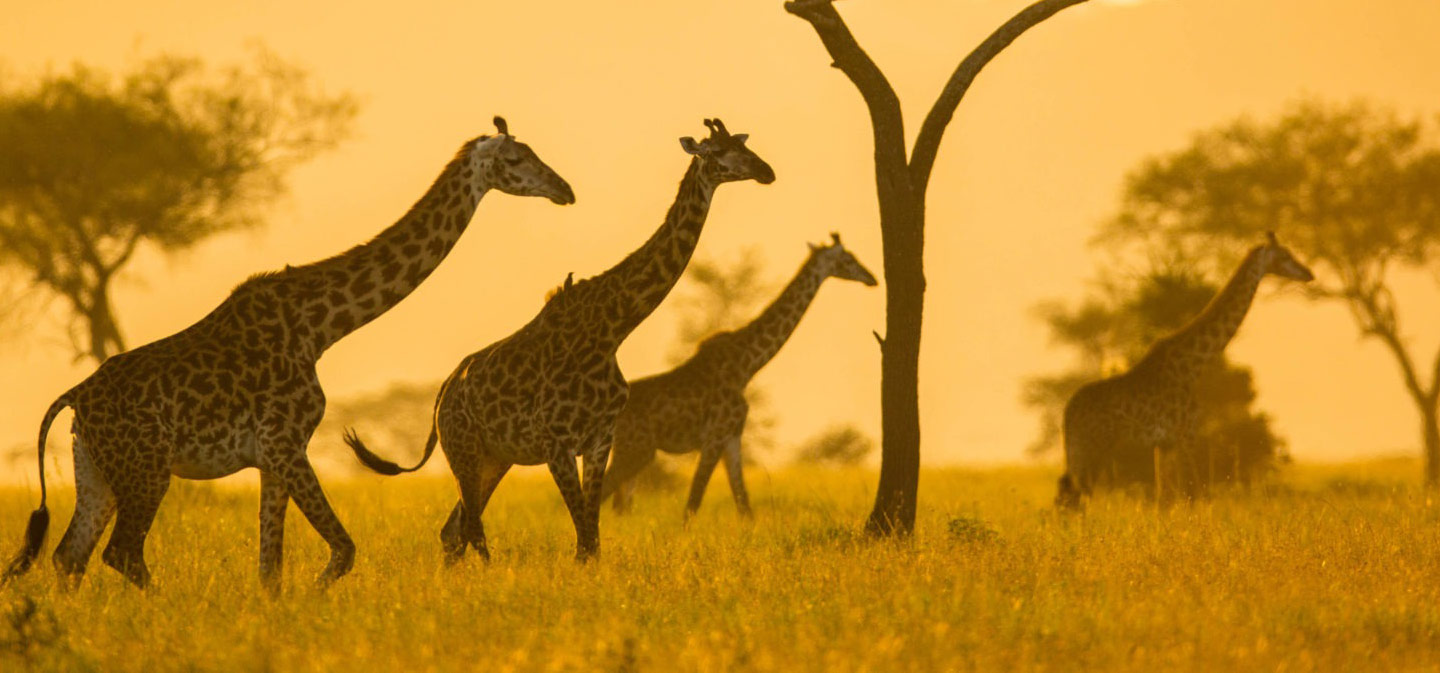
Wildlife, of course is what brings people to the Serengeti, and at that, the park isn’t lacking. All of the big five can be spotted while on safari in Serengeti, with an abundance of other animal species that include cheetah, Thomson’s and Grant’s gazelle, topi, eland, waterbuck, hyena, baboon, impala, African wild dogs and giraffe, jackals, Serval cats and many more. The park also boasts about 500 bird species, including Ostrich, Secretary bird, Kori bustard, Crowned crane, Marabou stork, Martial eagle, Lovebirds and the many species of vultures. As popular as Serengeti might be, it’s so vast that you might well be the only visitor around when a Leopard silently crouches in the tall grass towards unsuspecting impala, or when a Cheetah chases down a Thompson gazelle at a break neck speed across the golden plains in an epic struggle to fulfill the ancient adage of survival for the fittest in one of the world’s most beautiful wildlife sanctuaries.
Climate:
Like most of the parks it experiences two 2 rainy seasons. The long rainy season from March – May and the Short rainy season from mid November to mid December. It seldom rains through out the day during the wet season.
The Dry months are June- October and Mid December to February.
The temperature during the day is pleasant warm and cool to cold at nights and early mornings.
Best time to visit:
Serengeti National Park can be visited all year round.
The dry season (from late June to October) offers the best wildlife viewing in general, with the wildebeest migration crossing the Mara river at around July – September this may vary from year to year, but nevertheless if you are not lucky enough you will still be able to enjoy this spectacular event as the migration heads down to the central Serengeti in around November.
Also a spectacular time of the year to visit the Serengeti is during the wildebeest calving period, from late January to February in the southern plains of the Serengeti and Ndutu areas.
For those who want to avoid the peak season crowds, Serengeti only receives a handful of visitors and still ideal to visit in March, early April. At this time of the year the park is really peaceful with very few tourists, although it may rain for couple of hours a day the experience is worth it. Mega Adventures offers special rates for this period of travel, you may enjoy classic accommodations for very good prices.
Accessibility:
Throughout the year by,
By Air from Arusha/ Zanzibar
By Road through Ngorongoro Loduare gate, Lake Natron Kleins gate or from Mwanza through Ndabaka gate.
Accommodation:
Public Campsites, Special Campsites, Lodges and tented camps of various budget are available inside the park.
|
|
Tarangire National ParkTarangire, Tanzania’s sixth largest national park covers an untamed 2850 sq. Kms. Uncrowded and unspoiled, it possesses a wild beauty and contains most of the animal species expected to be se....
|
Details
Tarangire, Tanzania’s sixth largest national park covers an untamed 2850 sq. Kms. Uncrowded and unspoiled, it possesses a wild beauty and contains most of the animal species expected to be seen on a safari with the exception of Rhinos, which were wiped out by poaching in the 1980’s. The park has a range of different habitats, from grasslands and woods to the north to low hills, scrub and swampland down south. Cutting through these habitats is an evergreen corridor, the Tarangire River, the park’s main watering source for wildlife during the dry season. The park was named after this river that crosses it and empties its waters into Lake Burunge to the west. The park’s landscape and vegetation is of its own uniqueness with lightly wooded hills, dense bush and high grasses that can be found nowhere else in the northern circuit.
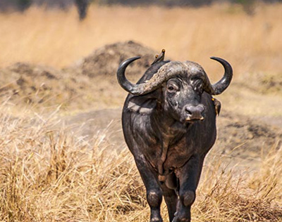
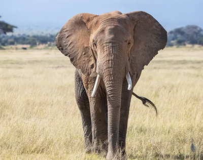
The park is famous for its large herds of elephants (up to 300 in a herd have been recorded) and baobabs, weird, ungainly and impressive trees that are several thousand years old and provide excellent silhouettes against the sky for sunset photos. Lions, leopards, cheetahs and its tree climbing pythons also attract a number of visitors throughout the season. Other large animals found in the park include wildebeest, zebra, buffalo, impala, Grant’s gazelle, hartebeest and eland among others. It is also the only park in Tanzania where rare antelopes such as the fringe-eared Oryx and peculiar long-necked Gerenuk are regularly observed.
The evergreen swamps are the focus for 550 bird varieties, the most species in any park in Tanzania and about a third of all Tanzania’s species. Tarangire is also one of the world’s most important breeding grounds for Eurasian migrants. Other species of birds found in the park include yellow-collared lovebird, the Kori bustard – world’s heaviest flying bird, Ostrich and small parties of ground hornbills. The woodlands are rich in hoopoes, hornbills, brown parrots and the white bellied go away bird. Game birds such as the helmeted guinea fowl, yellow necked spurfowl and crested francolin abound. Over fifty species of raptors have been recorded, from the common Bateleur eagle, whose name means “tumbler” in French, to the Steppe eagle, a migrant from Russia and giants such as the lappet faced vulture to the tiny pygmy falcon. Here, where birdsongs start well before dawn and continue well into the night is the keen birders’ “piece of heaven on earth”!
Climate:
Tarangire National Park like the Ngorongoro and Serengeti has bimodal rainfall. Short rains starting from November to December and long rains from March to May. It usually rains in the afternoon but seldom for the whole day.
The dry season is from June to October and January to February.
Temperatures during the dry season average at 26 C° in the afternoon and drop down to 14 C° during the evenings at night. Warm clothes for the evening and early mornings are recommended.
During the Wet season the temperatures are usually around 28 C° in the afternoon and around 16 C° at night.
The park is located at an altitude between 900m and 1250 meters with annual average rainfall ranging from 650 to 700 mm.
Best time to visit:
The Dry season, from late June to October, is the best time for wildlife viewing in Tarangire National Park. The Tarangire river which never dries act as a magnet to the wildlife in this ecosystem. Animals congregate around the Tarangire river making game viewing the best during the dry season. In contrast to the wet season most of the animals migrate out of the park, and wildlife viewing is considerably less.
Accessibility:
By Road: Tarangire National Park is easily accessible from Arusha city on tarmac road which is 121Kms from Tarangire National Park. It takes less than 2 hours to reach.
By Air: Chartered flight from Arusha airport or Kilimanjaro international Airport to Kuro Airstrip inside the Park.
Accommodation:
Tarangire National Park offers diverse options of accommodations inside and outside the Park. Public camping, Special camping, Tented camps, Tented lodges and Lodges .
Activities:
- Game drives
- Walking safari
- Night Game drives
- Camping
- Balloon Safari
|
|
Lake Manyara National ParkProbably Tanzania’s most beautifully set national park, Lake Manyara stretches for 50km along the foot of the Great Rift Valley’s western escarpment. It is also one of Tanzania’s ....
|
Details
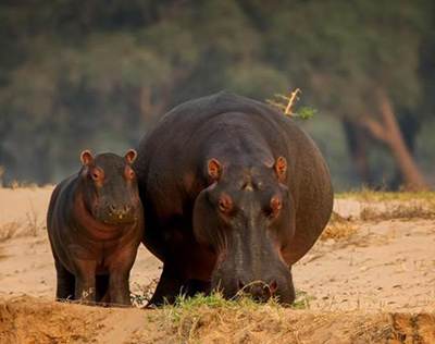
Probably Tanzania’s most beautifully set national park, Lake Manyara stretches for 50km along the foot of the Great Rift Valley’s western escarpment. It is also one of Tanzania’s smallest National parks, covering 330 sq. Kms (127 sq miles), of which up to 200 sq km (77 sq miles) is lake when water levels are high but its varied shoreline habitats shelter a wide variety of animals, including elephants, great flocks of flamingo, hippos and the renowned tree climbing lions.
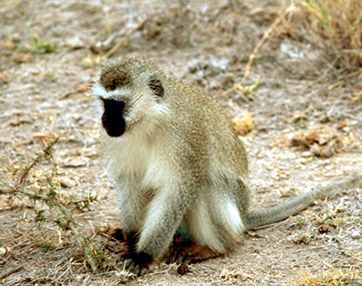
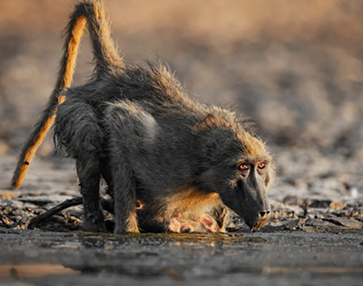
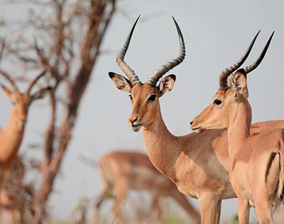
With its evergreen groundwater forest, Manyara is a touch of green in an otherwise dry landscape. This forest, fed by springs flowing down the escarpment wall in the north together with the many different habitats and the presence of year round water makes it an oasis for wildlife even during the dry seasons and attracts part of the wildlife migration from Tarangire. The forest is home to Manyara’s elephants, Impala, Bushbuck, Waterbuck, Guinea fowls and a host of other creatures alongside the ever present families of Blue and Vervet monkeys. Baboon troops also frequent the forest as well as on the plains adjacent to the forest.
Buffaloes usually feed by the lakeshore, sometimes numbering several hundred in a single herd. The fan delta that forms before the lake is a refuge for over two hundred hippos that with luck might be seen lounging out of the water during the day. Plains game includes Giraffe, Zebra, wildebeest, Warthog, mongoose, Kirk’s dik-dik and their attending predators; the tree climbing Lions, Leopards, Wild dogs and Jackals among others. Sometimes pairs of agile klipspringers can be seen silhouetted against the sky as they stand on rocks on the face of the escarpment wall. The shallow lakeshore is favored by water birds including Plovers, Ducks, Geese, Cormorants, Pelicans, Herons, Ibises, Jacanas and the highlight of them all, the vast flocks of pink flamingos who are attracted by the abundance of algae in the lake’s shallow waters. The algae are supported by a series of hot springs rich in the foul smelling Sulphur, that are heated by geothermal activities in the earth’s mantle.
Raptors that are found in the park include the long crested eagle that preys on the Vervets, many species of vultures, the pale chanting goshawk among others. Together there are about 400 bird species that have been recorded in the park, many a visitor’s highlight.
As small as it may seem, Lake Manyara, stretching along the base of the 600 meter high escarpment wall is one of the most beautiful places in Tanzania, a true scenic gem. With a setting so grand that Ernest Hemingway eulogized it as “the loveliest I had seen in Africa” and even named his book “The green hills of Africa” after the scene as he saw as he journeyed up the escarpment wall, Manyara is sure to enchant many a traveler now just as it did almost a century ago.
Climate:
Lake Manyara National Park like the Ngorongoro and Serengeti and Tarangire has bimodal rainfall. However its short rains may start a little earlier and end earlier October – November and the long rains March – May. It seldom rains for the whole day.
Manyara’s dry season is from June – September and December to February.
Temperatures during the dry season range from 24 C° during the day and around 14 C° during the nights. Warm clothes during early morning game drives is recommended.
Temperatures during the wet season are around 27 C° in the afternoon and around 16 C° at night.
Best time to visit:
Lake Manyara is great throughout the year. The park is at its utmost beauty during the wet season November – May when the vegetation is very lush and waterfalls cascade down the rift valley escarpment.
The dry season making most of the park routes accessible is preferred by many.
Accessibility:
The Park can be accessed both by road or air.
By Road 115kms from Arusha City.
By Air: Chartered flights to Manyara Airstrip.
Accommodation:
Lake Manyara National Park has diverse accommodation options a stone throw away from the park. From campsites, tented camps and lodges. Most of them are located on the edge of the rift valley with spectacular views.
The Park offers just a handful of accommodation options; Camping, tented camp and lodge
Activities:
- Game drives
- Night Game drives
- Walking Safari
- Canoeing
|
|
Mt Kilimanjaro National ParkWith its altitude of 5,895 m Mount Kilimanjaro, a three million years old stratovolcano, stands as the tallest mountain in Africa with the nickname “The rooftop of Africa”. The mountain....
|
Details
With its altitude of 5,895 m Mount Kilimanjaro, a three million years old stratovolcano, stands as the tallest mountain in Africa with the nickname “The rooftop of Africa”. The mountain originally comprised 3 volcanoes Kibo, Mawenzi and Shira that were formed about 1 million years ago. Mawenzi ceased erupting and Shira collapsed while Kibo continued erupting until about 150,000-200,000 years ago and is still technically only dormant. The very highest point was named Uhuru Point after Tanzania’s independence in 1961. Kilimanjaro is now the world’s highest free standing mountain.
Mount Kilimanjaro prides Mount Kilimanjaro National Park, which was declared a national park in 1973 and officially opened for tourism in 1977. The national park is located in Northern Tanzania, near the town Moshi, and covers an area of 1,688 sq km.
In 1987 the United Nations Educational Scientific and Cultural Organization (UNESCO) declared it a World Heritage Site and in 2013 it was declared a Natural Wonder of Africa.
The ascent of the slopes is a virtual climatic world tour from the tropics to the Arctic, with a total of five different ecosystems. The mountain’s ecosystems are as strikingly beautiful as they are varied and diverse
|
Cultivation Zone:
Big parts of the mountain lowland slopes, and first ecosystem zone, are used for farming bananas, maize crops, cassava and coffee, known as the cultivation zone this zone will start at an altitude of approximately 800 meters and end at an altitude of approximately 1,800 meters.
|
|
Montane Forest:
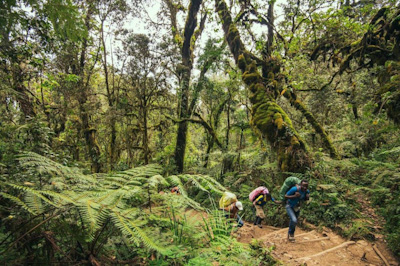
As reaching an altitude of approximately 1,800 meters a new climate zone begins. The montane forest . Where both blue monkeys and colobus monkeys are to be seen. With its vibrant colors, this rain forest jungle is simply amazing.
|
|
Heather & Moorland:
The rain forest climate zone ends at an altitude of approximately 2,800 meters, where the new climate zone, heather and moorland zone, begins. A climate with erratic changes of temperatures, reaching from above 40ºC during daytime and below 0ºC during nighttime. Eye leveling floating clouds and at the end of this climate zone at an altitude of approximately 4,000 meter only few clouds covering from UV rays.
|
|
Alpine Desert:
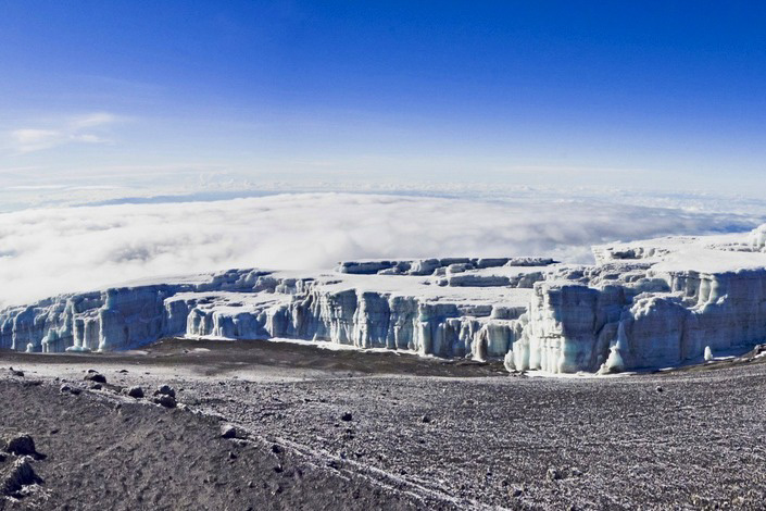
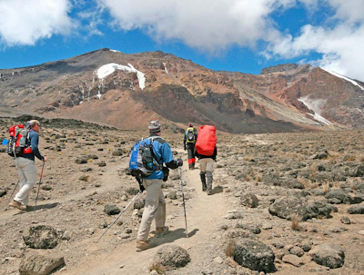
Where one climate zone ends another begins. With only a very little amount of annual rain, an oppressive sun and sub-zero temperatures, the climate of the alpine desert has begun. Revealing the ancient history of Mount Kilimanjaro with its volcanic rocks. With the views of the glaciers of the summit and deep gorges on the slope and branches in the crater rim where molten lava blasted through during prehistoric eruptions. A climate continuing to an altitude of approximately 5,000 meters.
|
|
Arctic Zone:
And to the last and final climate on the magnificent Mount Kilimanjaro, the arctic zone, which starts at an altitude of approximately 5000 meters and continues to the summit of the mountain, Uhuru peak, at 5,895 meters. With the stunning views of the eternal ice glaciers
|
Climbing to Kibo peak takes 5 to 8 days depending on the route. The more days, the higher the possibility to conquer the summit. There are six mountain routes one can choose from to reach the summit , each route offering different attractions and challenges.
Hans Meyer and Ludwig Purtscheller were the first people known to have reached the summit of Kilimanjaro in 1889. Follow in their footsteps by hiking spectacular routes namely Marangu route, Machame route, Lemosho route, Rongai route, Umbwe route and londrossi route to reach the roof of Africa.
Many conclude climbing Mount Kilimanjaro to be the highlight experience in Tanzania. As Kilimanjaro is one of the world’s most accessible high summits in the world, reaching Uhuru peak is an adventure that can be accomplished both by first-time mountain trekkers and experienced mountain trekking enthusiasts.
Climbing Kilimanjaro fits in well with a safari to the rest of Tanzania, and indeed great wildlife areas are so accessible by air or road. It would be a great pity not to plan this into your travel, even if it is not a full hike but only a single-day hike, where you hike via the marangu route from 1800 amsl to 2,720 amsl.
Climate:
There are two rainy seasons in a year. The long rainy season from March to May, where it rains around the mountain base and snow accumulates at the peak and the short rains from November to mid Dec.
The dry season is from late June to October and late December to February , the nights are cool and the days completely clear.
The park is located at an altitude between 1700 m to 5895 meter with annual average rainfall ranging from 828 mm at alpine desert to 2500 mm at Montane forest.
Best time to visit:
Mount Kilimanjaro can be visited throughout the year. However the climate is most suitable for climbing in the dry seasons June-October and mid December- February when the sky is clear and the mountain top is easily seen. Most people avoid April and May, when there are heavy monsoon rains. However the climb can be done provided you have proper climbing clothing and equipment.
Accessibility:
The park is accessible by road to all the route main entrances.
The park entrances are closest from Moshi town, making it the most preferred base for overnight prior to the climb.
Accommodation:
Among all the 6 routes the Marangu route is the only route that offers overnight in Mountain huts, the rest in public campsites. Mega Adventures offers all camping facilities during the trek.
Activities:
- Full hike
- Day hike or few days hike.
|
|
Arusha National ParkArusha National Park, Tanzania’s only national park named after a city, Arusha National Park is a jewel within easy reach. In spite of its proximity to the safari capital though, this park is....
|
Details
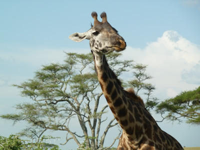
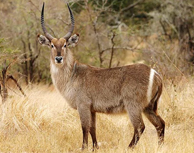
Arusha National Park, Tanzania’s only national park named after a city, Arusha National Park is a jewel within easy reach. In spite of its proximity to the safari capital though, this park is hardly visited – a welcome news to those adventurous few who come here to enjoy this tiny park’s expansive views, beautiful volcanic scenery, breathtaking rainforest and abundant wildlife in relative solitude.
Taking up most of the park’s space is the mighty Mt. Meru, a stratovolcano that was once higher than Mt. Kilimanjaro and Tanzania’s second highest mountain. A quarter of a million years ago, a violent eruption blew off its entire eastern wall, hurling gigantic boulders some 70 Kms east of the mountain and reducing its height to the current 4566 meters. Although classed as dormant, earth tremors still occur and a series of minor eruptions were recorded in 1910. Hiking Africa’s fifth highest mountain is often looked upon as an acclimatization and fitness trip prior to scaling Kilimanjaro and despite the fact that Meru’s summit is over a kilometer lower than Kili’s, the climb is a lot more steeper and can be just as challenging and rewarding as scaling Africa’s roof top. Some breathtaking scenery is to be had along the way including unmatched views of its bigger neighbor and herds of Buffaloes, Giraffes and Zebras grazing calmly as you passionately wind your way through the seemingly endless mountain trail.
Although a big portion of this park’s 552 Square kilometers consists of Mt. Meru’s eastern section has more than that on offer. There is the dense forest, home to the elusive Leopard, the acrobatic black-and-white colobus monkey and other primates plus an assortment of jungle birds. At the foothills of Mt. Meru lies the Ngurdoto crater, an unbroken 3km wide, 400m-deep volcanic caldera unsurprisingly named “the little Ngorongoro”.
Like Ngorongoro, this crater was formed when, after merging, two volcanic cones finally collapsed under their own mass. Also like its bigger cousin some 200Kms to the east, Ngurdoto plays host to a rich variety of wild game. Herds of buffalo, Elephants and Zebras along with troops of baboons can be seen on the crater floor from special viewpoints on the south rim as descending down to the crater floor is prohibited though walking around the crater rim escorted by an armed ranger is allowed.
To the northeast of the park are the Momella lakes, a series of seven shallow alkaline lakes formed when Meru blew off its eastern wall. As in most alkaline lakes, these too support a thriving variety of algae which account for the lakes’ different shades of emerald and turquoise and in turn support a sizeable population of filter feeders such as the crimson colored lesser flamingos who actually gain this lovely color form from the algae they eat. Other water birds include ducks, grebes, pelicans and a host of migratory birds that usually fly in between May and late October adding up to the park’s 575 different bird species that have been observed to date, making it an ideal birder’s nest.
The park’s tropical conditions also make it an excellent place for butterflies, assuring butterfly fanatics a grand treat. The forests around the lakes also harbor a good number of black-and-white colobus monkeys plus blue monkeys, buffaloes, elephants, giraffes, zebras, warthogs and the occasional bushbuck. Lions are virtually nonexistent in this park, with Leopards and Hyenas present but hard to spot. Nevertheless this one of those little gems tucked away in a pristine evergreen wilderness just a hop, skip and a jump from Tanzania’s safari capital and one that will always live to one’s expectations.
Climate:
There are two rainy seasons in a year. The wet season is from March to May and from November to mid December. The dry season is from late June to October and late December to February
The park is located at an altitude between 1,700 and 4566 meters.
Best time to visit:
Arusha National Park can be visited throughout the year. However the climate is most suitable for climbing in the dry seasons June-October and December-February when the sky is clear and the mountain top is easily seen. Most people avoid April and May, when there are heavy monsoon rains. However the climb can be done provided you have proper climbing clothing and equipment.
Accessibility:
The Park can be accessed by road.
By Road: From Arusha town 32 kms, from Moshi 67 kms
Accommodation:
For the hikers on Mount Meru, accommodation is in huts at designated campsites.
Camping inside the park for those on game drives and many options of lodges are available just outside the park and in Arusha which is just a stone throw away.
Activities:
- Hiking Mount Meru
- Game drives
- Walking safari
- Canoeing
- Horse riding
|
|
Nyerere National ParkNyerere National Park was established in November 2019 from part of the legendary Selous Game Reserve which was designated a UNESCO world heritage site in 1982 due to its diversity of its wild....
|
Details
Nyerere National Park was established in November 2019 from part of the legendary Selous Game Reserve which was designated a UNESCO world heritage site in 1982 due to its diversity of its wildlife and undisturbed nature. The Nyerere National Park is now Africa’s Largest National Park. The Park with a staggering size of 30,893km2 hosts one of the world’s largest concentrations of wildlife. The collection of wildlife both in diversity and abundance is astounding. Visitors to this vast sanctuary will be able to witness a wide range of wildlife species both rare and common.
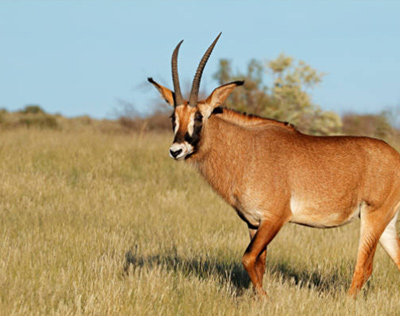
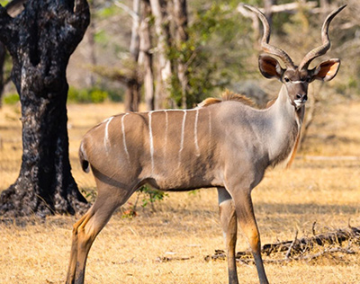
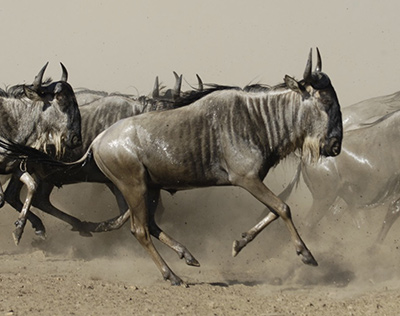
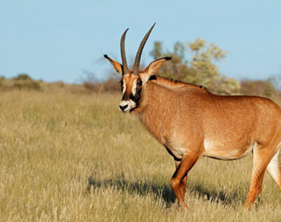
The park hosts the famous ‘Big Five’ and some rare species of antelopes like Roan, Sable, Brindled Gnu, Lichtenstein hartebeest, Kudu etc.
Located in Southern Tanzania and far from the madding crowds of the Northern circuit this magnificent ecosystem remains virtually untouched by man. With only a handful of safari camps and very few visitors it is largely undiscovered, utterly pristine, it remains the last wilderness frontier.
Originating from the Rufiji River – the park’s lifeline – a network of channels, lakes, lagoons, sandbanks and swamps form one of Africa’s most outstanding ecological systems – giving life to abundant game, and extraordinary bird life.
The habitats include Acacia savannah, wetlands and extensive miombo woodlands.
Climate:
Nyerere National Park is located at an altitude between 100 and 400 meters
Dry season sets in during June to November.
The rainy season Jan –April
Best time to visit:
The best time to visit Nyerere National Park is June to October which is also the high season. Wildlife is much easier to watch during the dry season, when the animals gather at water points as well as the presence of thinner vegetation.
The rainy season is wonderful for birdlife and lush scenery .
Accessibility:
Nyerere National Park is accessible either by regular charter flight into the Park (Daily flights) from Dar, Kilimanjaro & Arusha, or by road from Dar es Salaam city (5 hrs Approximately).
Accommodation:
As for accommodation, supremely private luxury tents at pristine locations overlooking the mighty rufiji inside the reserve for the high end travelers or accommodation in bandas or camping a few kilometers outside the reserve is suitable for the budget travelers.
Activities:
- Walking safaris
- Game drives
- Open Game drives
- Boat safaris
- Fly camping
- Fishing
- Wilderness picnics
|
|
Ruaha National ParkWith its 20,226 sq km Ruaha National Park former biggest National Park in Tanzania (now the Nyerere National Park), also making it one of the largest protected areas in East Africa, and is located ....
|
Details
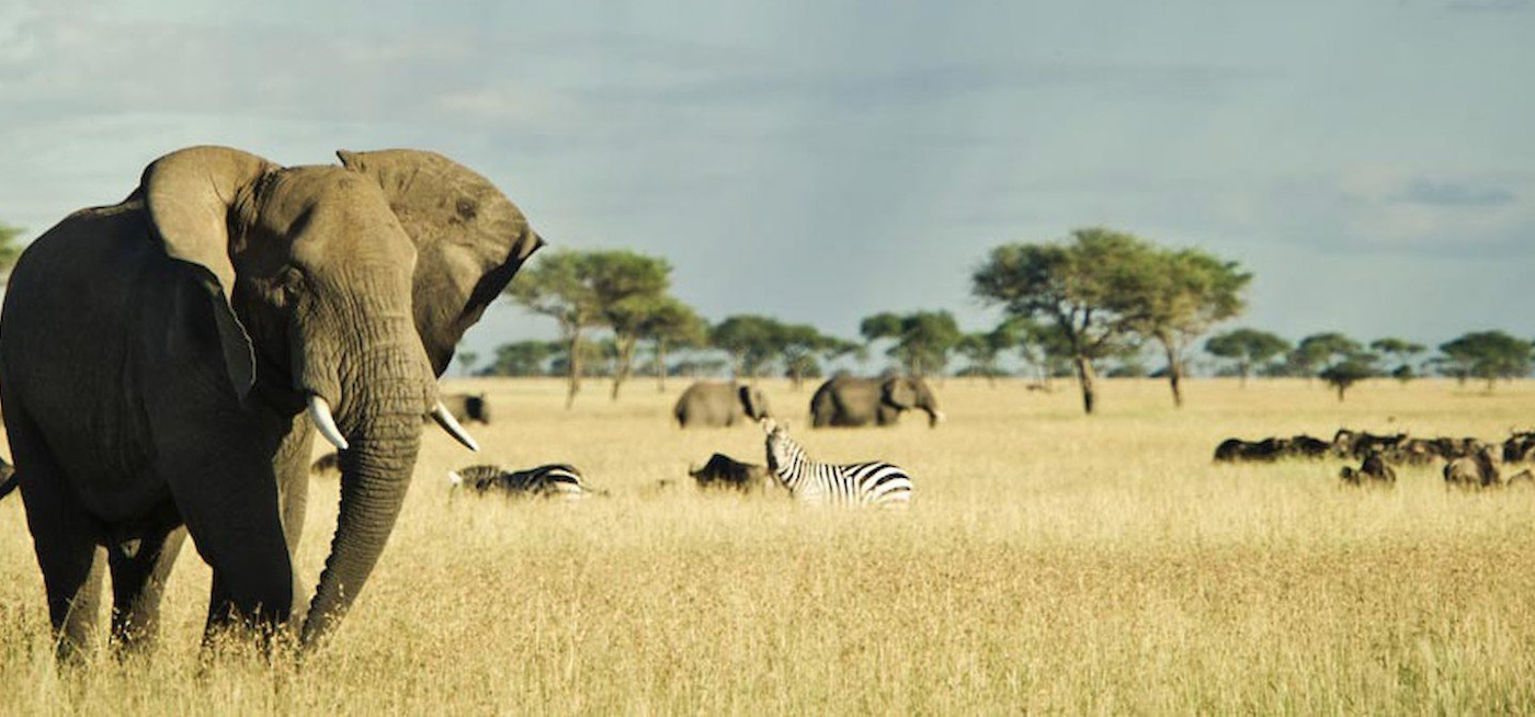
With its 20,226 sq km Ruaha National Park former biggest National Park in Tanzania (now the Nyerere National Park), also making it one of the largest protected areas in East Africa, and is located in south-central Tanzania. The national park has its name from the Great Ruaha River, which flows along its entire eastern boundary and is the focus for game-viewing, which also becomes one of the main water sources during dry-season.
With only a handful of visitors Ruaha National Park remains untouched and unexplored. With its pristine ecosystem size and unique location it is most likely that Ruaha National Park will continue experiencing only a few visitors each year. This makes Ruaha National Park a perfect choice for an off the beaten track itinerary.
Ruaha is located where two vegetation zones meet, the Zambezian and the Sudanian, making this national park a mix of tropical and subtropical grasslands, savannas, shrublands and drier grasslands and acacia savannas, providing a varied and interesting wildlife with a stunning scenery to explore.
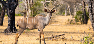
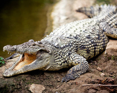
Ruaha National Park is a birder’s paradise, by being home to more than 571 species of birds. Other than providing a spectacular birding, Ruaha is also the place to find the magnificent Greater Kudu. Home to many rare wildlife species such as the Sable & Wild dogs. Giraffes, Zebras, Lions, Leopards, Cheetahs and many more without forgetting the Crocodiles & Hippos are in abundance.
Not only does the water supply of this national park serve for the wildlife within it, but also for human beings. Making this national park economically significant as it supports agricultural activities and contributes to hydro-electric power.
Climate:
Ruaha National Park has temperatures ranging from 16 – 27 °C.
Ruaha National Park enjoys only one rainy season, dry season is between June and October and its wet season is November to May with annual average rainfall ranging from 500 to 800mm. The park is located at an altitude between 750 and 1868 meters.
Best time to visit:
Ruaha National Park can be visited all year around, however game viewing is at its best during the dry season. Animals are drawn to the Great Ruaha River and other water sources. Ruaha’s dry season is between June and October.
Accessibility:
The park is accessible by road and air.
Road: From Iringa town it is 108 km to the main gate (Y-Junction), 625 km from Dar es Salaam. For the guests who want to visit this park in combination with the Northern circuit parks and explore the country by road, we drive from Karatu to Dodoma for overnight 7-8hrs drive and further to Ruaha on the second day, a great way to explore the country and its people.
Air: Daily scheduled flights from Dar es Salaam and Arusha are the easiest way to Ruaha.
Accommodation:
As regarding accommodation when visiting Ruaha National Park the park has a public and special campsites, as well as a hostel, self-catering bandas and cottages. And for more comfort the park has numerous lodges and permanent camps.
Activities:
- Walking Safari
- Game drives
|
|
Mkomazi National ParkEveryday thousands of people pass within a few kilometers of Mkomazi on one of Tanzania’s busiest highways without even noticing that this emerald is within a few kilometers of the highway. M....
|
Details
Everyday thousands of people pass within a few kilometers of Mkomazi on one of Tanzania’s busiest highways without even noticing that this emerald is within a few kilometers of the highway. Mkomazi, a virgin breathtaking beauty exhibiting unique natural treasures and immense sense of space – adds to the fulfillment of high visitor enjoyment expectations – a much needed bridge between northern circuit and coastal attractions.
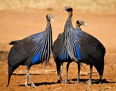
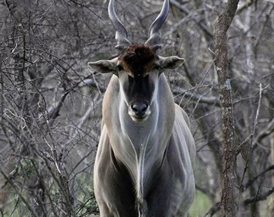
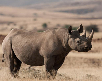
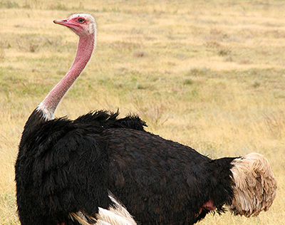
A game reserve since 1951, this new national park takes its name from the Pare tribe word for a “scoop of water“ referring to little water. It is a fantastic destination for bird watchers with more than 450 avian species recorded, among them dry and country endemics such as the Cobalt- chested vulturine guinea fowl, other large ground birds such as Ostrich, kori bustard, Secretary bird, ground hornbill and some migratory species including Eurasian roller. It is also a refuge for two highly endangered species, the charismatic black rhino and the sociable African wild dog both of which were introduced in the 1990`s.Nomadic by nature the wild dogs maybe seen anywhere in the park, but black rhinos are restricted to a fenced sanctuary for their safe keeping for the future. It also supports several country specialist species that are rare elsewhere in Tanzania. These include the spectacular Fringe eared Oryx, Lesser kudu and Gerenuk.
Located in Northern Tanzania, it covers an area of 3,245 sq km (1,240 sq miles).The National park splits between Kilimanjaro and Tanga regions and also borders the Tsavo west national park in Kenya. Within sight to the northwest is Mount Kilimanjaro, Africa’s highest summit. To the south, the Pare and Usambara Mountains form a dramatic backdrop. Kenya’s vast Tsavo National Park shares a border with Mkomazi. Together it forms one of the largest and most important protected ecosystems on earth. Being only 112km (69 miles) from Moshi makes it qualifies to be visited in a day, however for more promising experience we do recommend a night stay.
Habitat: Mkomazi is the southern tip of the Sahel zone. It is a classic dry-country reserve of grey-green nyika bush, ancient baobab trees and isolated rocky hills. Elsewhere, the seas of bush give way to open savannah woodlands of umbrella acacias and mbugas – shallow valleys of grassland.
Climate:
Normally dry except for the long rainy season March – May and short rains October – December, the average annual rainfall is between 570mm at low elevations and 1,910mm at high elevations. July and August are the coldest months.
Best time to visit:
The park is most scenic during the green season November -June, Elephants and other herbivores migrate from the neighboring Tsavo National Park during this time.
The dry season, Late June to October is the best time for wildlife viewing in Mkomazi National Park. Animals congregate at water sources making them easier to spot.
Accessibility:
The park is accessible throughout the year using the Moshi – Dar highway. Approximately 113kms from Moshi town.
Accommodation:
One semi permanent tented camp near the park headquarters for those who prefer more luxury accommodation, otherwise mobile camping for the adventurous ones.
Activities:
- Game drives
- Walking Safaris
- Hiking
|
|
Gombe National ParkGombe National Park was first recognized as an important wildlife and chimpanzee habitat in 1943 when it was designated a Game Reserve and was later upgraded to National Park status by the Tanzania....
|
Details
Gombe National Park was first recognized as an important wildlife and chimpanzee habitat in 1943 when it was designated a Game Reserve and was later upgraded to National Park status by the Tanzanian Government in 1968. With its just 52 sq km this is the smallest national park in Tanzania. It is located on the western border of Tanzania to Congo on the shore of Lake Tanganyika.
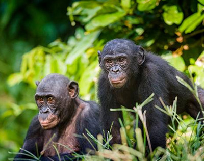
The park is pervaded by steep valleys and forest vegetation ranging from woodland to grassland to tropical rainforest, making this the perfect home for chimpanzees. The main attraction in Gombe is certainly the chimpanzees that live protected within the boundaries of the national park. With guided walks visitors are taken through the forest in quest of spotting and sit with these fascinating great apes, who share about 98% of their genes with humans. Undoubtedly a remarkable experience providing life-long memories and surely a highlight of many visitors.
The forest’s habitat of chimpanzees is what made this national park famous, as the chimpanzees originally were the object of research by the renowned scientist and conservationist Dr. Jane Goodall whose studies started in 1960. Jane Goodall spent many years in the forests of Gombe studying the behavior of the endangered chimpanzees and founded a behavioral research program, which is the now longest-running study of its kind in the world.
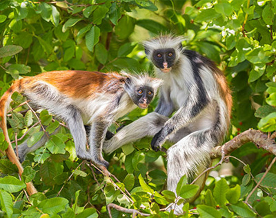
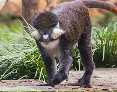
But chimpanzees are not the only wildlife in Gombe National Park, as its forests also hold a variety of other wildlife. Noticeably Gombe National Park is a monkey’s paradise, with the tropical rain forest being home to several species ranging from olive baboons, red colobus, red-tailed monkeys, vervet monkeys and blue monkeys, who are part of the gentle monkey family who are gentle by nature from birth. But not only is Gombe home to monkeys, it is also a home to over 200 species of birds, bushpigs and a variety of snake species. Further in the dense forest small antelopes are inhabited.
Besides trekking with the chimpanzees, visitors can also take a swim in Lake Tanganyika which is considered by many as the cleanest and purest water on earth, which makes it wonderful to swim in. But more than that the lake has the greatest diversity of Cichlid fishes in the world. Cichlids are generally brilliant colored freshwater fishes that are a joy to watch either by snorkeling above them or using scuba gear to swim down amongst them. If your wish is not to be inside the water, the lake can be enjoyed from wonderful boat excursions.
Getting around in the park is not by a safari vehicle like other national parks. In Gombe National Park hiking is the only way to explore this park which truly brings you in touch with nature.
Climate:
Unlike other National Parks and places in the country which have two wet seasons. Gombe National Park experiences one wet season which begins in November – April. It seldom rains throughout the day but afternoon thundershowers are likely to have.
The dry season is from May – October.
May to August have the coldest nights with minimum temperatures of up to 15°C. Afternoon temperatures are usually around 27°C. September & October have the highest temperatures of the year, but with just a slight increase compared to other months.
November – April have the coolest days but with the highest humidity. Afternoon temperatures range around 25°C to 17°C during the night.
Best time to visit:
The best time to trek the chimps is during the dry season where they tend to be more in the lower slopes of the mountains, specifically June – November as it may be possible to experience some rain in May as it is the start of the dry season. It might take longer to find the Chimps during wet seasons. Sometimes up to 4 hours of trekking.
Accessibility:
By air, from Arusha airport (subject to availability) for those extending their adventures after covering the Northern Safari Circuit or daily domestic flights from Julius Kambarage International Airport in Dar to Kigoma town. You can reach Gombe by a private boat transfer from Kigoma approx 1.5Hrs boat ride.
Accommodation:
Accommodation inside the park can either be in a campsite or a tented lodge.
Activities:
Chimp trekking: The park has put in place strict rules to safeguard visitors and the chimps. Allow at least 2 days to at least see them as there are no guarantees where they could be each day.
- Hiking
- Swimming
- Snorkeling
|
|
Mikumi National ParkMikumi National Park is located in the southern safari circuit, and forms part of the northern ecosystem of the famous Selous Game Reserve. Mikumi National Park is only 3-4 hrs from Dar es Salaam, ....
|
Details
Mikumi National Park is located in the southern safari circuit, and forms part of the northern ecosystem of the famous Selous Game Reserve. Mikumi National Park is only 3-4 hrs from Dar es Salaam, lying alongside the highway to Zambia and en route to Udzungwa, Ruaha and Kitulo National Parks.
The park covers an area of 3,230 sq. km (1,250 sq. miles), making this sanctuary the fifth largest national park in Tanzania. The park has a diversified ecosystem that is further divided by the road that runs across the park. The road separates the park into two sections, the North West and the South East. With a scenery often compared to Serengeti, the north-west area is characterized by plains consisting of vegetation such as acacia, tamarinds, baobab and some rare palm trees. On the other side of the road is the less accessed part of the Mikumi national park. The vegetation is thick, dominated by shrubs and with less abundance of wildlife makes it less exploited.
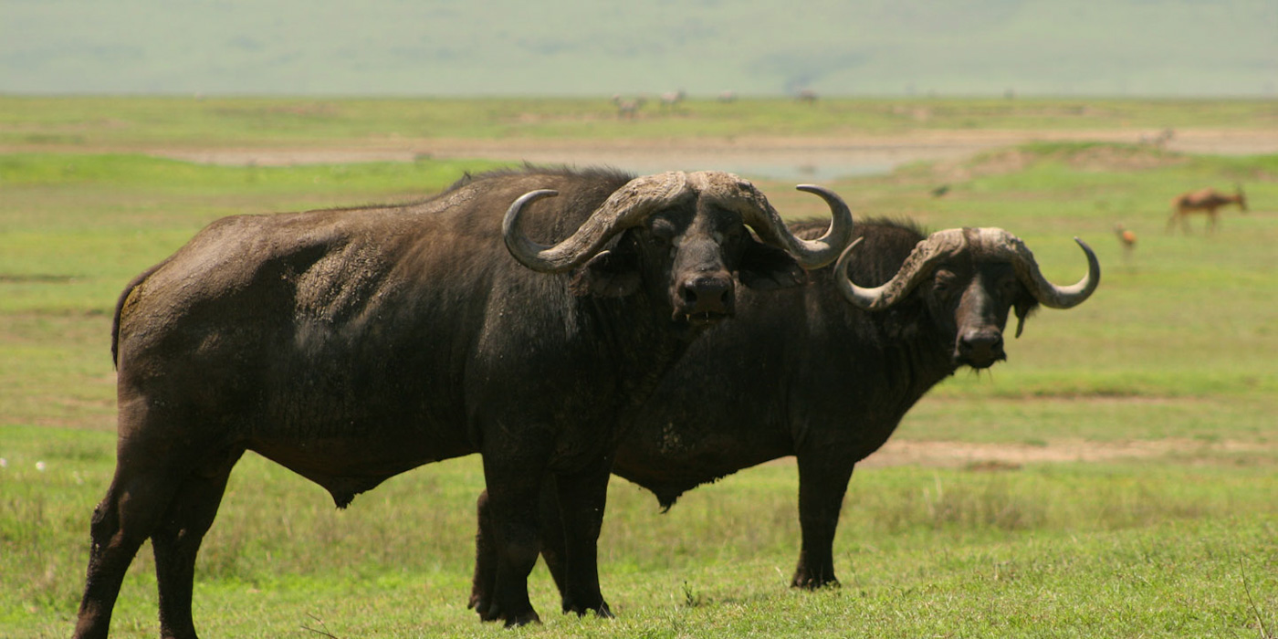
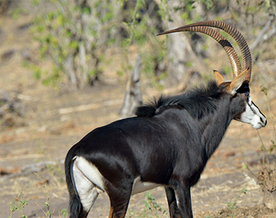
Mikumi national park holds a diverse number of wildlife, large herds of Elephants, Buffalos, Zebras, wildebeest, hyenas, Leopards, Lions, Sable Antelopes, Greater Kudu, Baboons, impalas and more than 400 species of birds. As this National park shares the same ecosystem with Selous Game Reserve herds of elephants, zebras and buffaloes migrate to and from the northern part of the game reserve into the national park.
Climate:
The Park experiences two rainfall seasons, short rains starting from October to early November and long rains from March to May. Dry season is from late June to September and December to February.
The park is located at an altitude between 200 and 800 meters.
Best time to visit:
With the well established network of roads Mikumi National Park can be visited all year round, although Mikumi’s dry season lasts between May and November.
Accessibility:
Mikumi National Park is easily accessible using the Dar – Zambia highway. Mikumi National Park is only 3-4 hrs from Dar es Salaam.
Accommodation:
If your wish is to stay overnight inside the park, the park offers accommodation options such as Bandas, public campsites and Tented Camps. Just outside the National Park are various accommodation options as well.
Activities:
- Game drives
- Walking safari’s
|
|
Udzungwa Mountains National ParkBy being Africa’s oldest rainforest the Udzungwa Mountains National Park truly has a unique ecosystem with breathtaking scenery. In a wide arch that runs over 800 kilometers down the eastern ....
|
Details
By being Africa’s oldest rainforest the Udzungwa Mountains National Park truly has a unique ecosystem with breathtaking scenery. In a wide arch that runs over 800 kilometers down the eastern part of Tanzania are seven ancient mountain ranges. This mountain range is East Africa’s barrier against the humid wind of the Indian Ocean. From the rising air fall torrents of hot rain, thunderstorms and lightning, and endless weeks of mist and cloud. This pattern has existed for tens of thousands of years, creating the oldest rainforest in Africa, which is also among the oldest in the world.
In its 1,990 sq km it has the second largest biodiversity of a national park in Africa, ranging from grassland, tropical rainforest, miombo woodland to mountain forest and steppe prides with waterfalls. These forests are surrounded by drier savannas, and their isolation has led to the evolution of the most unique and varied life of animals and plants in all of Africa. Yet the most fascinating thing about them is how unexplored they are.
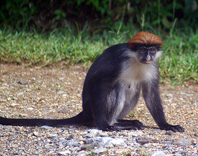
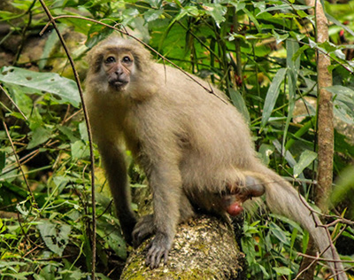
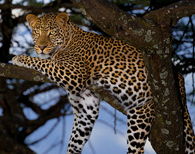
It is a naturalist’s paradise with dozens of unique species across the animal spectrum from insects to reptiles and frogs to birds and primates. And in addition to having a spectacular and unexplored nature with more than 400 species of birds, Udzungwa Mountains National Park is a sanctuary of many endemic and endangered species of flora and fauna. The protected area holds 2500 species of plants of which 25% are endemic and furthermore holds six species of primates of which five are endemic. A complete new species of monkey, the Sanje mangabey was discovered as recently as 1979, and a new species of francolin (partridge family) was first discovered by scientists in 1992. The Sanje mangabey, together with Iringa red colobus, can only be found in Udzungwa National Park. The wildlife also includes buffalo, elephant, leopard, forest antelope, warthog and bush pig. Lions live in the woodlands and upper moorlands but are rarely seen.
Being a hiker’s paradise, Udzungwa Mountains offers hiking and trekking possibilities for everyone. May it be a demanding 6-day trekking route or a 1-hour elementary hike. As a break for the hiking visitors can have a refreshing dip in the waterfall plunge pool whilst admiring the dazzling view of the 170 m Sanje Waterfall. The Udzungwa Mountains are a year around destination time for hiking.
The Udzungwa Mountain National Park can add a very interesting extension to other destinations in southern Tanzania such as Ruaha, Mikumi and Nyerere National Park.
Climate:
The national park has an altitude range from 250-2,576 meters, and remarkably there are parts where almost this entire altitude range has unbroken forest cover, from miombo through bamboo to lowland and highland forest.
The year round temperature in the park is pleasant. Depending on the month, the average high temperatures range from 25-30 C°, but at times, it has also peaked close to 35 C° during the humid short rain season. The warmest months are October – March and the coolest are May – July. The average low temperature is about 17-23 C°, but the temperatures have previously dropped to about 12 C°.
Like other locations in Tanzania, Udzungwa Mountains Park has a rainy season and dry seasons. The dry season is from June to October.
Best time to visit:
Possible all year round although slippery during rainy seasons. The dry season is June-October before the short rains however be prepared for rain anytime in the forest.
Accessibility:
Good network of roads, 5 hours drive from Dar es salaam, 2 hours from Mikumi National Park.
Accommodation:
A true place for nature lovers, there are no lodges or tented camps inside the park. Camping is the only option for visitors who wish to overnight within the park borders.
Outside the borders of the national park are modest but comfortable accommodation with en suite facilities.
Activities:
|
|
Saadani National ParkWhere the bush meets the beach. Wildlife walking in the white sand along the shores of the Indian Ocean, with palm trees swaying in the cooling ocean breeze and the African sun sparkly alluringly r....

|
Details
Where the bush meets the beach. Wildlife walking in the white sand along the shores of the Indian Ocean, with palm trees swaying in the cooling ocean breeze and the African sun sparkly alluringly reflective in the clear blue water. Saadani National Park is the only national park in East Africa where you can enjoy wildlife one moment and then the next be walking along a sandy beach and swimming in the surf of the Indian Ocean
Saadani National Park, which is located in the eastern region of Tanzania, has been known as a game reserve since 1969, but was officially declared a national park in 2005. With its 1,062 sq km and absolute unique scenery Saadani is the only wildlife sanctuary in Tanzania bordering the sea.
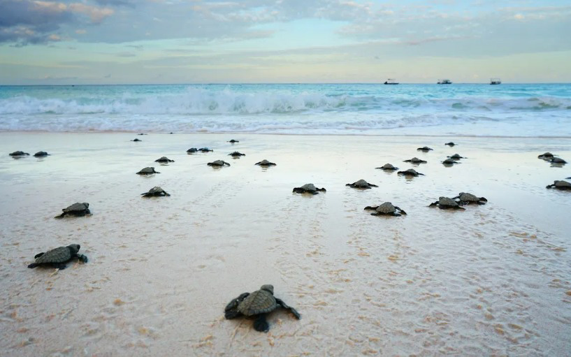
Saadani has about 8 km of sea front and of these at least 3 km are unspoilt beaches. This undisturbed nature of beaches makes a favorite place for green turtles to lay their eggs, making this beach the most important breeding site for turtles in all of Tanzania.
The name ‘Saadani’ has a link to the 19th century, where there was an Arab settlement in the Area. It was the name of a fisherman’s village and plays an important role for the history of the country, as it was mentioned in chronicles of the Portuguese and notable travelers like El-Masoud, Richard Burton, Johannes Rebmann and Ptolemy among others. The fisherman’s village not only hosted these travelers, but were also once the place for a trade center coordinating overseas and hinterland bather trade, including slave trade.
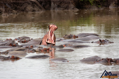
A one of a kind paradise with a unique and extraordinary ecosystem, a naturally fascinating setting, where both marine and mainland flora and fauna is to be found. Where baboons are walking and a variety of monkey species are climbing in the trees. Herds of giant elephants walking together with buffalos. Where the tallest animal in the world, the noble Maasai giraffes, are walking calmly. If you look closely, leopards might be resting in the trees. Furthermore animals such as hartebeest, waterbucks, wildebeests, duikers, dik-dik, mongooses, genets, porcupines, warthogs and the beautiful sable antelopes can be spotted. On boat trips on the Wami River even hippopotamus and crocodiles can be spotted. And since 2005, the protected area has been considered a Lion Conservation Unit and the beaches in the Saadani National Park form one of the last major green turtle breeding sites on the mainland in Tanzania. Generally the purpose of Saadani National Park is protection and conservation of the coastal zone.
Together with stunning scenery this national park offers a varied range of activities besides regular game drives. These activities include guided walks, swimming and snorkeling, boat trips and the option of visiting the Saadani fishing village, which lies within the reserve.
When visiting Saadani the national park offers various types of accommodation as a public campsite at the beach, as well as special campsites in other parts of the park together with other accommodation facilities inside and outside the park.
Climate:
Saadani National Park experiences tropical climatic conditions. Like most of the parks in Tanzania Saadani National Park it experiences two wet seasons, long rains from March – May and the short rains from November – December. During the short rains it is likely to have few hours of rain during the day but will rarely extend throughout the day.
Being located close to the equator and the warm Indian ocean, it is humid throughout the year.
The coolest months are June – September with afternoon temperatures average 31 C° to 21 C° at night.
The warmest months are October – May with afternoon temperatures average 33 C° to 23 C° at night.
Best time to visit:
Saadani National Park can be visited all year around with wildlife plentiful everywhere, but during the green season of March-May and November and December some parts may be inaccessible.
Accessibility:
Easily accessible from Dar es Salaam, about 5 hours drive most of which is on the highway the park is also accessible from Arusha after covering the Northern circuit for those opting for Combo packages to cover the Eastern and Southern Park of Tanzania, or those who want to explore the country by road visiting the Usambara and further to Saadani before heading for their outbound flight in Dares Salaam Julius Nyerere International Airport.
By Air Saadani National Park can be accessed from Zanzibar, Dar es Salaam and Arusha town.
Accommodation:
The Park offers various types of accommodation options. From Rest house, Bandas, Camping ground, Lodges and Tented Camps both inside and outside the park
Activities:
- Game drives
- Walking Safari’s
- Swimming
- Boat trips
- Camping
|
|
Mahale Mountains National ParkMahale Mountains National Park is named after a picturesque range of mountains in Mahale, which are within its borders; the park is located on the eastern shore of Lake Tanganyika in Kigoma Region,....
|
Details
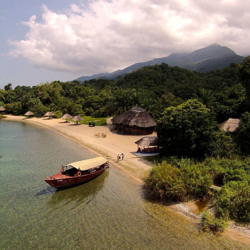
Mahale Mountains National Park is named after a picturesque range of mountains in Mahale, which are within its borders; the park is located on the eastern shore of Lake Tanganyika in Kigoma Region, Tanzania.
The Mahale National Park has several distinctive characteristics. As one of the few protected areas for chimpanzees in the country, the park is conveniently situated near Gombe Stream National Park, made famous by Jane Goodall.
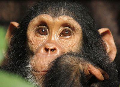
Mahale Mountains National Park boasts a sizable undisturbed natural habitat. Its remoteness harbors the largest population of eastern chimpanzees; the chimpanzees flourish peacefully within the thick forests. One can also experience the co-existence of two incredible wild species, chimpanzees and lions.
Visitors can only access and experience wild adventures at Mahale National Park on foot. There are no roads or other infrastructure within the park boundaries, and the only way in and out of the park is via boat on the lake. Such terrains at the national park have given the locals (the Batongwe and Holoholo people) a highly attuned attitude to the natural habitat, living gracefully around the park with virtually no impact on the ecology.
Climate:
Mahale is located close to the equator, which makes the climate to range from warm to hot and humid. Throughout the year climate doesn’t change. Average temperatures are about 27°C/81°F during the day and cool down to about 17°C/63°F in the Evenings. Mahale’s Dry season is from May to October. The Wet season is from November to April. The rains come in the form of afternoon thunderstorms and seldom last the whole day. The heat at the park can be oppressive due to the high humidity.
Best time to visit:
The best accessible and easy-going time is during the dry season (that lasts from May to October). This time of the year the Mahale chimpanzees are likely to be seen in big groups, and the sunshine illuminates the entire forest and Lake makes a perfect relaxing moment at the park. But Mahale the Park is also accessible all year round. During the rainy season, the visit can be a memorable experience, made remarkable by views of the neighbouring country DR Congo across the water and by far-fetched lightning storms that light up the lake at night.
Accessibility:
The Mahale Mountains National Park is accessible all year round by air, road, and boat. There are flights, cars, and boat options to suit most travellers.
Accommodation:
Campsites, Lodges, and tented camps of various budgets are available.
Activities:
- Chimp trekking
- Camping safaris
- Snorkeling
- Sports fishing
- Kayaking
|
|
Lake NatronLake Natron is located northeast of the Ngorongoro Crater and forms part of Africa’s immense Great Rift Valley. Settled between rolling volcanic hills and deep craters, Lake Natron sits at th....
|
Details
Lake Natron is located northeast of the Ngorongoro Crater and forms part of Africa’s immense Great Rift Valley. Settled between rolling volcanic hills and deep craters, Lake Natron sits at the lowest point of the rift valley at 600 meters above sea level – and is probably the world’s most alkaline body of water.
Lake natron area is hot and often very dry and dusty – so certainly for the bolder traveler. But those who choose to include Lake Natron as part of their safari itinerary are satisfied with an area far off the beaten path and get relatively little tourism. It is also some of the most theatrical scenery in Tanzania, and the tour here is very worth it.
The transfer towards Lake Natron takes around three hours from Mto wa Mbu town beside Lake Manyara. It is hot on the day, but the landscape is increasingly dramatic, with the Rift Valley rising on your left-hand side. You will soon focus on looking around, and the views are spectacular. Drive deep into the green vegetation that gives way to a sparse, dusty landscape.
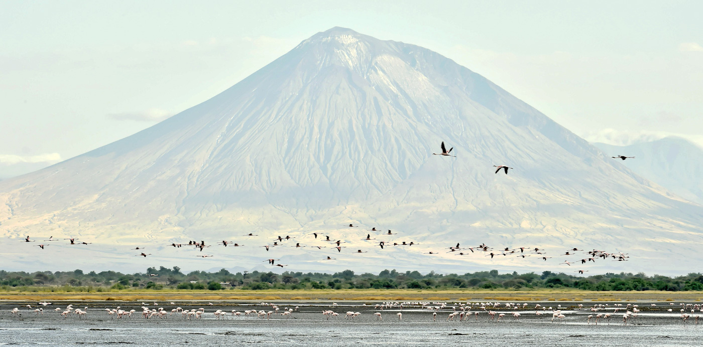
To the north of this path stands great mounds, the ruins of extinct volcanoes. These are soon dwarfed by the glimpse of the active Ol doinyo Lengai. To finally reach Lake Natron, you will drive around an imposing volcano and sometimes catch a glimpse of its smoking crown.
Wildlife of Lake Natron:
The area around Lake Natron is supported some of the wildlife, you might see the occasional zebra or giraffe, but this is one among many reasons to come here.
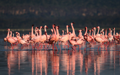
Lake Natron itself is home to a fascinating ecosystem that flourishes in this harsh environment. The lake consists of millions of Cyanobacteria, salt-loving microorganism that produces their food. As the lake increases in salinity, it also attracts more populations of various bacteria. The lake also hosts a vast number of blue-green alga with red pigments and Spirulina, on which a good number of Lesser Flamingoes feed on.
Lake natron is considered a very aggressive environment, and other organisms cannot live here. The levels of alkalinity become so concentrated at a period that they almost approach that of straight ammonia. Very few predator species can live here, making it a safe breeding ground for the flamingoes.
Climate:
Lake Natron has a tropical savanna climate (with dry winter). The area receives irregular seasonal rainfall, mainly between December and May. Temperature at the lake often range between 24°C to over 40 ° C.
Best time to visit:
Lake Natron is accessible all year round for travellers.
Accessibility:
Lake Natron national park is accessible by road or by air and travellers can visit any time of the year. Flying over the lake offers the special experience with the view of lake serene beauty from the ground.
Accommodation:
Campsites, Lodges, and tented camps of various budgets are available.
Activities:
Walking safari is the making activity in the Lake Natron area. You can walk across the baked mud to the shores of the lake, in which algae and zooplankton thrive, which attracts the flamingos that line the lake’s shore.
Look back at the fascinating view of Ol doinyo Lengai standing tall among rolling hills and flat plains. Its ash-grey color and smoking top remind you that this is still very much an active volcano. The walk around lake natron is best done early in the morning or late afternoon, escaping the heat of the day.
Explore the water fall:
One can include a walk to explore the waterfall when visiting Lake Natron, it is a great experience. The Ngare Sero Waterfall is in the Lake Natron area, below the foot of Ol Doinyo Lengai Mountain. Visitors always add the visit to Waterfalls as part of an extended stay in the region including a Lake Natron stay and/or climbing Ol Doinyo Lengai (Mountain of God).
Hominid foot prints tour:
Walk to hominid footprints provides a unique opportunity to enrich a fact-finding trip to northern Tanzania. A place where researchers have catalogued as a rare find of well-preserved human footprints left in the wet volcanic mud between 5,000 and 19,000 years ago. It’s the only site in Africa with many ancient Homo sapiens footprints, making it a unique site that tell the story of humankind’s earliest days. For best experience a Hominid foot prints tour is done in conjunction with a sundowner.
Take the challenge to hike to the Ol doinyo Lengai to its summit (Not for everybody):
Ol Doinyo Lengai, a sacred “Mountain of God” in the Maa language (Maasai Language), an active volcanic mountain positioned in the Gregory Rift, south of Lake Natron. Ol Doinyo Lengai is part of the volcanic system of the East African Rift valley.
From its summit crater you will have majestic views in the north of the hot barren salt flats of Lake Natron stretch into the distance with a pink colored flamingo covering the grounds, past lies the Kenyan border. From the east the view is dominated by Mount Kilimanjaro and west the forested escarpments and hills comprising the western slopes of Great African Rift Valley. And from the south is the Crater Highlands of Ngorongoro.
The Ol doinyo Lengai climb is so demanding due to the day time heat, steep and unstable slopes of ash and crumbly rocks and lack of water. An early morning climb is recommended and the best approach is climbing from the west where the morning sun can be avoided for a while.
|
|
Katavi National ParkKatavi National Park is the third-largest national park compared to other Tanzanian national parks. It is by far one of the parks that receive fewer visitors, making it a genuinely untouched and un....
|
Details
Katavi National Park is the third-largest national park compared to other Tanzanian national parks. It is by far one of the parks that receive fewer visitors, making it a genuinely untouched and undisturbed wildlife paradise. Katavi National Park calls the western Tanzania circuit home, and it is considerably challenging to reach by road, so the convenient way is through charter flights.
Katavi National Park is mainly fed by the Katuma River, transforming the park into a beautiful wetland in the rainy season in April and May. Lake Katavi and Chada are both recurrent lakes located within the park borders. The park has various combinations of riverine forests, bushland, Miombo forests, and grasslands in terms of its vegetation.
Climate:
Katavi National Park is commonly hot, and it stays that way throughout the year since the park is located near the equator crossing. At night it is pretty different from other parks since its typically warmer (approximately 20°C or 68°F). During the day, the Temperatures are about 32°C or 90°F. Its broad difference in altitude (816 m to 1634 m or 2,677 ft to 5,361 ft) is responsible for the temperature variations. Fortunately, the areas commonly accessed by tourists are mainly on low altitudes.
Best time to visit:
Visitors who come to Katavi National Park during the dry season from June to October will have the best time to see wild animals. The Katuma River is the only water source during the dry season and is the main lifeline for creatures both large and small when they congregate along the river to drink and bath.
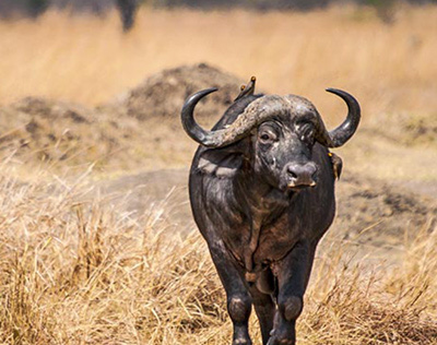
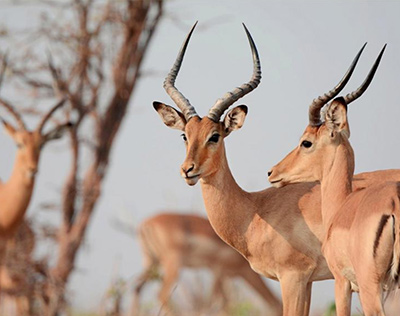
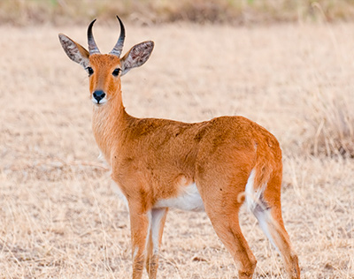
It is one of the few parks you can catch a sight of the sable and roan antelope in the same place. Other wild animals grazing here are hartebeest, eland, zebra, giraffe. Katavi national park also boasts massive herds of buffalo, some reaching a thousand or more. A healthy elephant population of around 3,000 also lives in the park. Predators such as jackals, cheetahs, hyenas, and servals are present. A pride of lions is constantly moving around hunting for their next meal.
Over 400 diverse species of birds, Katavi is an incredible place for bird lovers. Large groups of storks like open-billed, saddle bills, spoonbills, fish eagles, crested barbets, Bateleurs, lilac-breasted rollers, and paradise flycatchers are but a few on the list of various birds’ species in Katavi national park.
Accessibility:
Getting to Katavi for visitors can be arranged through one of the available charter flight services, but also Katavi National Park can be accessed via ground transportation: estimates vary widely; it is generally discussed not in hours but in days.
Accommodation:
Campsites, Lodges, and tented camps of various budgets are available.
Activities:
- Game drives
- Night Game drives
- Walking Safari
- Bird watching
|
|
Enduimet Wildlife ManagementEnduimet wildlife management area (WMA) lies in West Kilimanjaro. It is bordered by Kilimanjaro National Park on the South-East, while on the North, it connects the Tanzania-Kenya political boundar....
|
Details
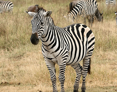
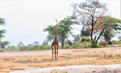
Enduimet wildlife management area (WMA) lies in West Kilimanjaro. It is bordered by Kilimanjaro National Park on the South-East, while on the North, it connects the Tanzania-Kenya political boundary.
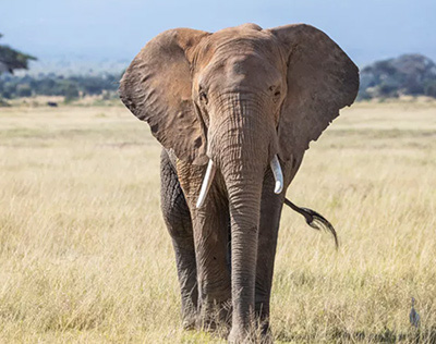
The Enduimet WMA harbors fantastic views of Mt Meru and the Majestic Mt Kilimanjaro. Various wild species, including Elephants, Giraffe, Buffalo, Leopard, Oryx, Wildebeest, Bushbuck, Hyena, Thomson Gazelle, Grants Gazelle, and other small animals. It connects the Mkomazi, Arusha, Kilimanjaro National Parks Tsavo & Amboseli ecosystem.
Climate:
The summers are short, warm, and overcast and the winters are short, comfortable and dry. Over the course of the year, the temperature typically varies from 14°C to 30°C and is hardly below 12°C or above 32°C.
Best time to visit:
Best time to visit Enduimet wildlife management area is in November when the area is fully green, but visitors can visit all year round.
Accessibility:
Enduiment Wma can be reached using numerous roads; a gravel road from Bomang’ombe through Sanya Juu and Engare Nairobi to Rongai, a rough road from Arusha-Namanga Road junction at Longido village to Sinya, Ngereiyani, and Tingatinga. During rainy seasons some roads and tracks inside the area are not passable.
Accommodation:
Campsite, Lodge, and tented camps of various budgets are available.
Activities:
- Photographic safaris
- Motorbike Adventures
- Walking safaris
- Night Game drives
|
|
Karatu TownKaratu district is a small vibrant town located next to the Ngorongoro Conservation Area, it is bordered by the Ngorongoro crater rim on the North eastern side, Lake Manyara to the east ....
_edited.jpg)
_edited.jpg)
|
Details
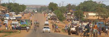
Karatu district is a small vibrant town located next to the Ngorongoro Conservation Area, it is bordered by the Ngorongoro crater rim on the North eastern side, Lake Manyara to the east and Lake Eyasi to the South west.
Karatu hosts variety of accommodation options which serves as an ideal spot to overnight for travellers on safari in the Tanzania northern circuit.
|
|
|
|


_edited.jpg)

_edited.jpg)